
Page 8 - W M Donald Newsletter - Edition Twelve
P. 8
Meshes, point clouds, and non-uniform rational basis splines*: welcome to the world of 3D CAD modelling
8
After leaving school, Gary Burnett spent eight years as a brickie before joining W M Donald as a trainee engineer. Initially Gary learned on the job and then completed an HNC in Civil Engineering in Dundee. Gary is a Site Engineer who has transferred into the office and is now W M Donald’s lead on CAD modelling.
‘3D CAD models have become indispensable in civil engineering and they are particularly useful as part of the tendering process. During this process, 3D models are made to calculate the cut/fill volumes of a site.
Traditionally, surveyors would visit site and collect a series of survey points (topographical survey) that would then be brought back to the office and used to create a CSV survey file from which a 3D model could be built. W M Donald still uses state-of-the-art surveying technology, such as the SX10 Trimble Total Station which can operate as a laser scanner, but the real breakthrough has come with the use of drones to collect data.
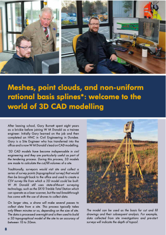
On larger sites, a drone will make several passes to collect data from a site. This process typically takes only fifteen minutes or so, depending on the size of site. The data is processed overnight and is then used to build a 3D topographical model of the site to an accuracy of between 10 to 30mm.
The model can be used as the basis for cut and fill drawings and their subsequent analysis. For example, data collected from site investigations and pre-start surveys will indicate the depth of topsoil.
